Automated Mapping and Assessor's Information
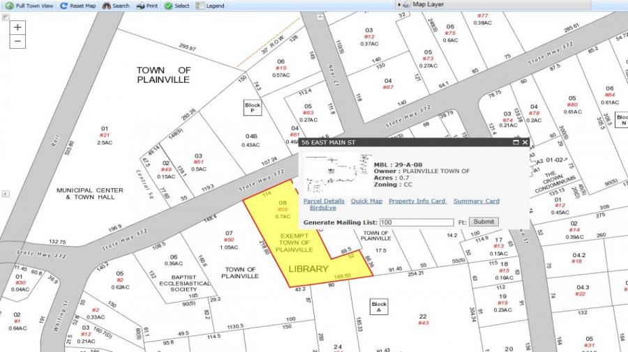
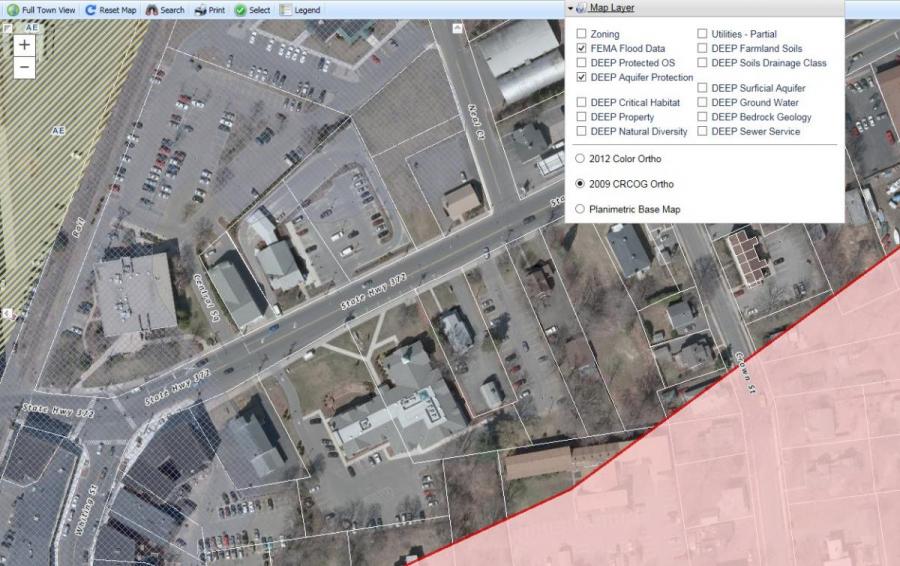
You can view maps of any Plainville property as well as obtain Assessor's data by clicking here. Below are a few examples of what can be done with this new program. It allows you to search any property in the Town of Plainville, then by clicking on the lot, you can access the property card, and even view a 3-D aerial shot. Under the Map Layers pull down menu, you can see if your property falls within a certain zoning district, floodplain area, or aquifer protection area.